Mars Rover Testing Methods
Sand and Rock Yards (Rover Testing Facilities)
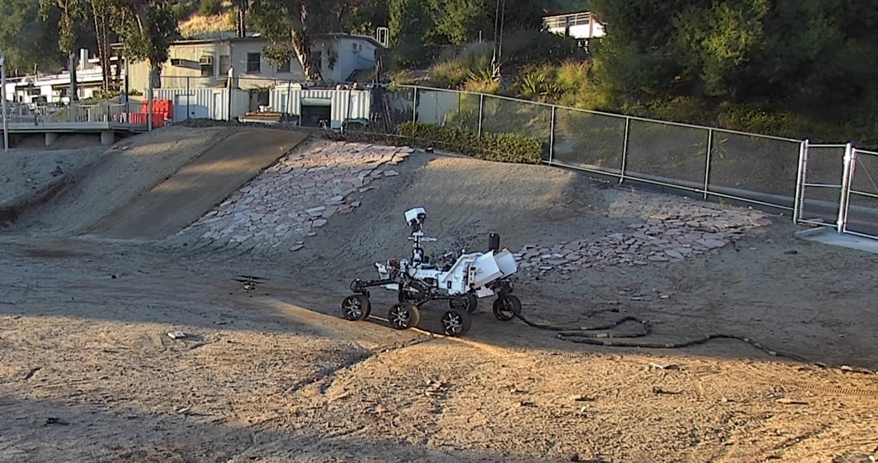
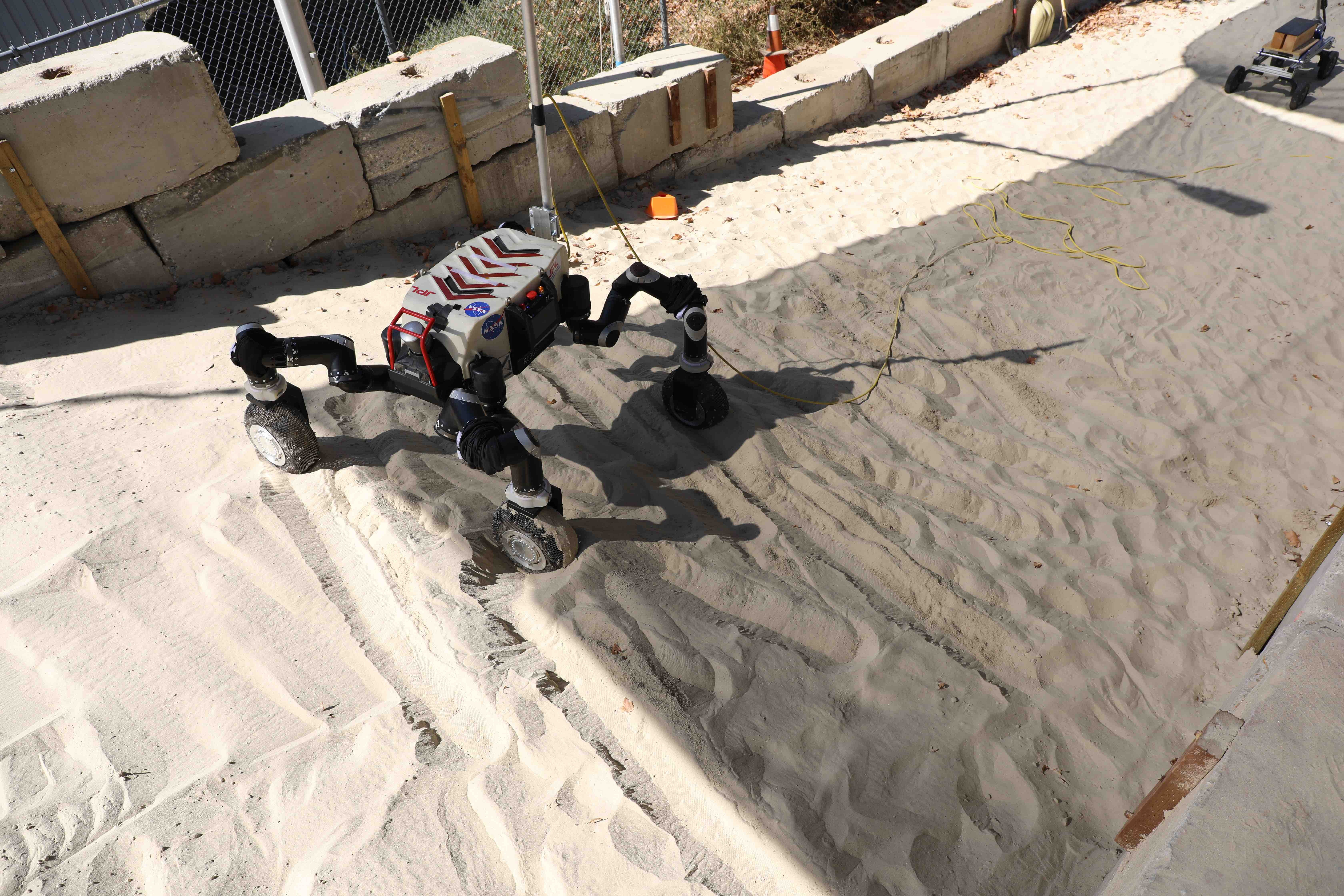
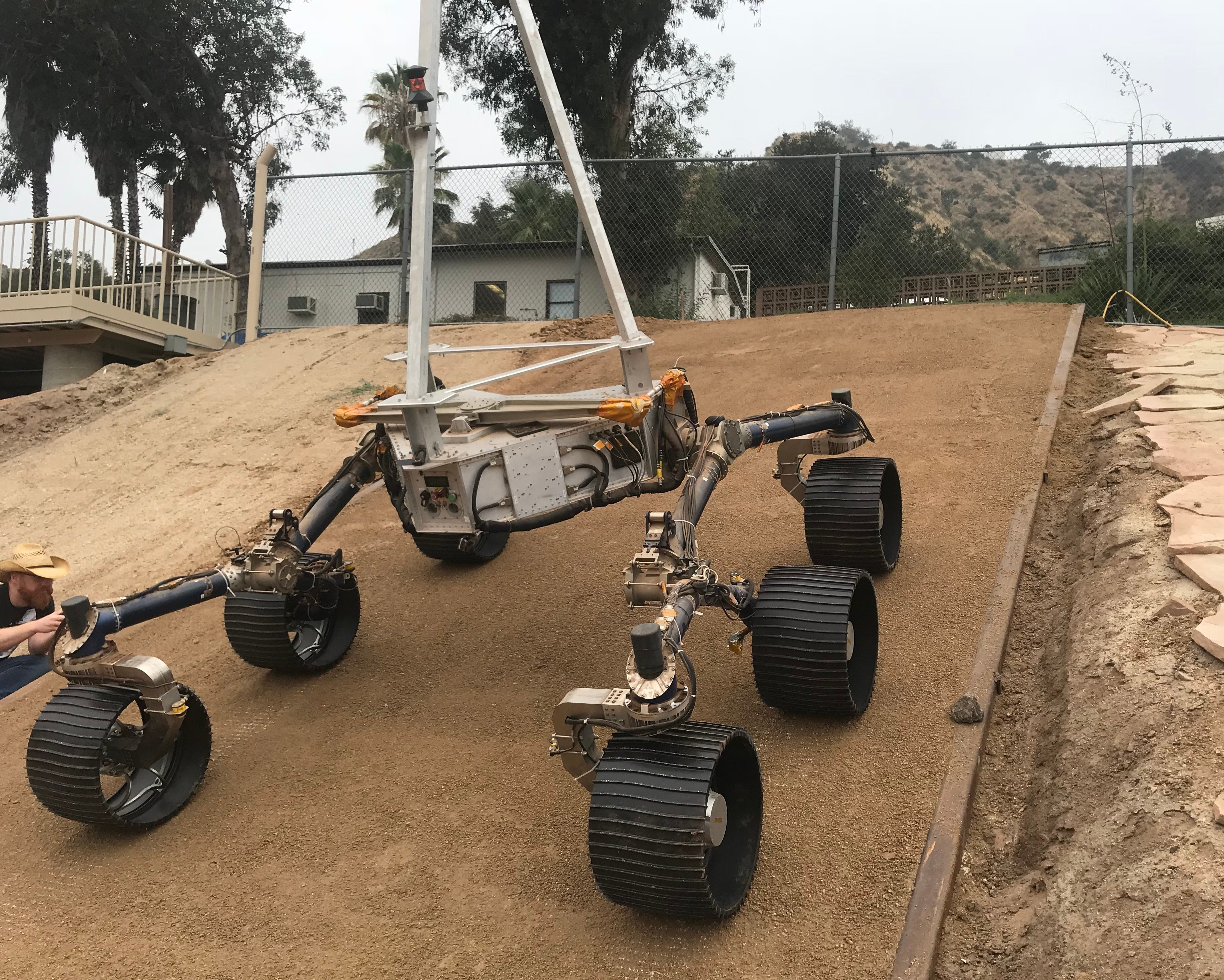
NASA’s JPL Mars Yard:
The Jet Propulsion Laboratory (JPL) has a dedicated outdoor facility known as the Mars Yard. This facility is designed to simulate Martian terrain with various obstacles and surfaces, including rocks, sand, and slopes, to test the mobility and capabilities of Mars rovers like the Mars Science Laboratory (Curiosity) and Mars 2020 (Perseverance).
European Space Agency (ESA) Planetary Utilisation Testbed:
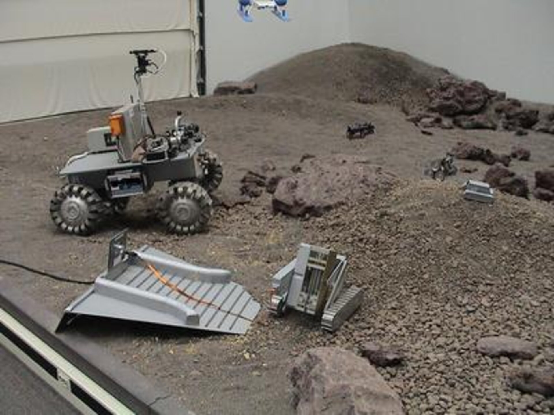
Similar to NASA's Mars Yard, this facility is designed to mimic extraterrestrial surfaces, including those of Mars, for testing rover prototypes and landing technologies. The testbed is composed of square 8x8 m terrain area filled with various sizes of sand, gravel and rock.
The terrain is articulated in four different areas:
- a small crater
- a boulder field
- a sandy dune
- a gravel slope area
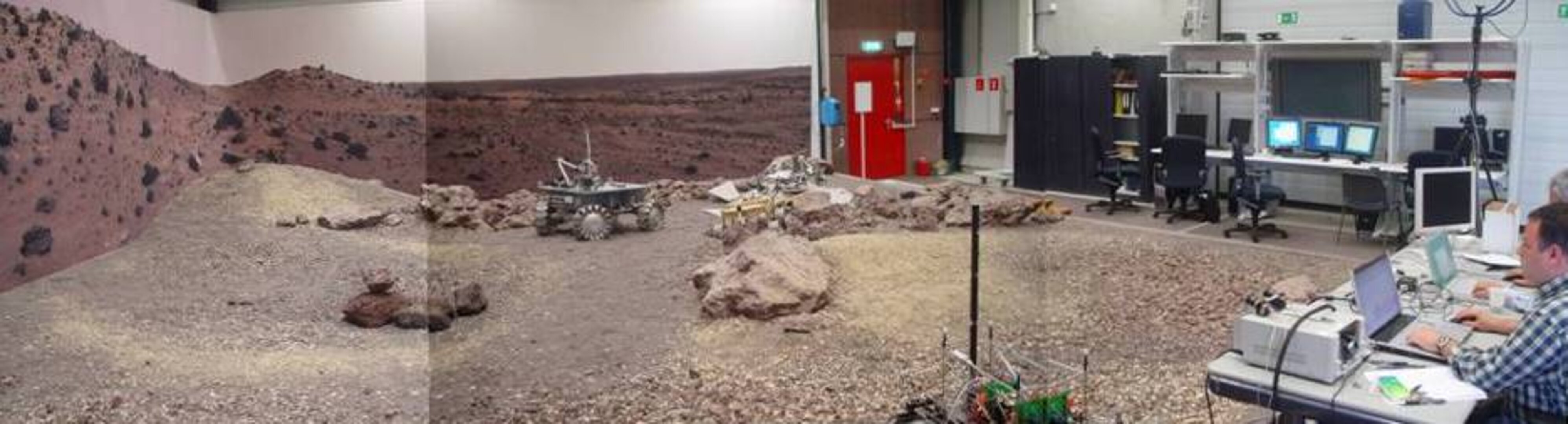
ESA's Planetary Utilisation Testbed
ESA's Planetary Utilisation Testbed
Other testing methods
These have less application in this program but they are interesting.
- 3D printing is used by agencies to recreate specific Martian terrains in high detail based on data from Mars orbiters. These models allow engineers to test rover navigation and instrumentation against known terrain features that rovers will encounter on Mars.
- Computer modeling and simulations are used to test rover systems in various scenarios that a rover might face.
- Environmental Simulation Chambers simulate Martian atmospheric conditions such as temperature[^3], pressure, and chemical composition. These chambers can also simulate dust storms and other weather phenomena to test the durability and functionality of rovers under harsh Martian weather conditions.
- Some tests may use scaled-down models of rovers or specific subsystems to evaluate particular design elements or the interaction of multiple systems in a controlled setting.
Topographic Data
Since the idea of using Martian landscape data was floated, I sought out sources of that kind of data. I haven't looked closely at this data yet and some of it would require GIS software to view properly
- Sketchfab - Mars Terrain Model
- Mars Global CTX Mosaic downloads - main page for Mars Mosaic (CalTech - Bruce Murray Lab for Planetary Visualization) - may require ArcGIS to view
- HiRISE (High Resolution Imaging Science Experiment)
- camera aboard the MRO provides high-res images
- Context Camera aboard also provides wider area images at lower res, useful for larger landscape contexts
- USGS Astrogeology Science Center
- Google Mars
- ESA Mars Express
- OpenTopography
Rover stuff
Sources
[1]: Yen, et al. ROAMS: Rover Analysis, Modeling, and Simulation
[2]: Lindemann. Dynamic Testing and Simulation of the Mars Exploration Rover
[3]: Ramachandran, et al. Space Environmental Chamber for Planetary Studies
[4]: Replicating a Rcok on Mars